How Google Earth Pro helps clean energy development
Featured technology
Google Earth Pro
Utility-scale solar and wind
Who we’re helping:
Partners
Solar and wind developers
Our role:
Helping solar and wind developers accelerate clean energy project development by evaluating potential sites and streamlining site design and construction estimates.

Google Earth Pro helps the solar and wind developers accelerate clean energy project development by evaluating potential sites and streamlining site design and construction estimates.
Renewable technologies like solar and wind will be key to helping us meet our energy demands and our goal of running on 24/7 carbon-free energy on every grid where we operate. Utility-scale solar and wind projects take time and resources, and accelerating this clean energy deployment with decision support tools can help companies like Google meet our decarbonization goals.
For several solar and wind energy developers, Google Earth Pro has been cited as a mission-critical decision support tool in the process of siting, designing, and constructing new clean energy projects. These new clean energy projects lead to meaningful greenhouse gas reductions, and Google Earth Pro plays an important role in many such projects. Our analysis indicates that in 2024, Google Earth Pro helped enable our partners to reduce more than an estimated 15 million metric tons of GHG emissions in the US alone.1
Evaluating potential solar and wind sites
We recently spoke with engineering manager, Dan Tamarkin, about his use of Google Earth Pro at Invenergy, which is the largest private clean energy developer, owner, and operator in North America with 33 GW of projects around the world that could power 12.7 million homes. Dan uses Google Earth Pro daily while developing sites, pulling in useful datasets such as flood plain data, habitat information, roads, buildings, airports, and wetlands. When Dan analyzes this data, he can then draw polygons around parcels of land to communicate important development information with others.
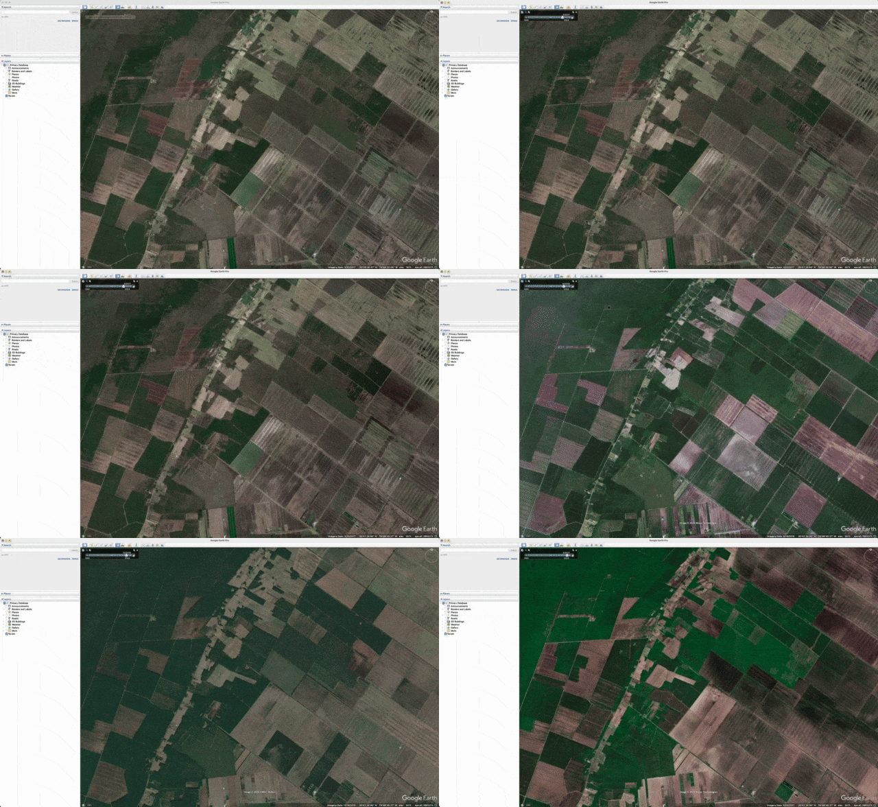
Dan and his colleagues use Google Earth Pro to ensure nothing is missed when considering the feasibility of a site. For example, identifying the flood risk of a project will influence its design and ultimately the cost of the electricity it produces. Developers use the product’s historical imagery feature to look at satellite images over time and see if an area is prone to flooding or not. Similarly, Dan will zoom into the land on Google Earth Pro and study the satellite imagery, following discolorations in vegetation to better understand a site. Dan says that “This helps us to be aware of any potential constraints on the project and adjust siting as necessary.”
Streamlining site design and construction estimates
Once a site is selected for further development, Dan uses Google Earth Pro to perform due diligence. He sends project files as KML files to external consultants, such as geotechnical engineers, who will help with construction analysis. Dan says, “We use Google Earth [Pro] because it is ubiquitous and all engineering firms have it.”
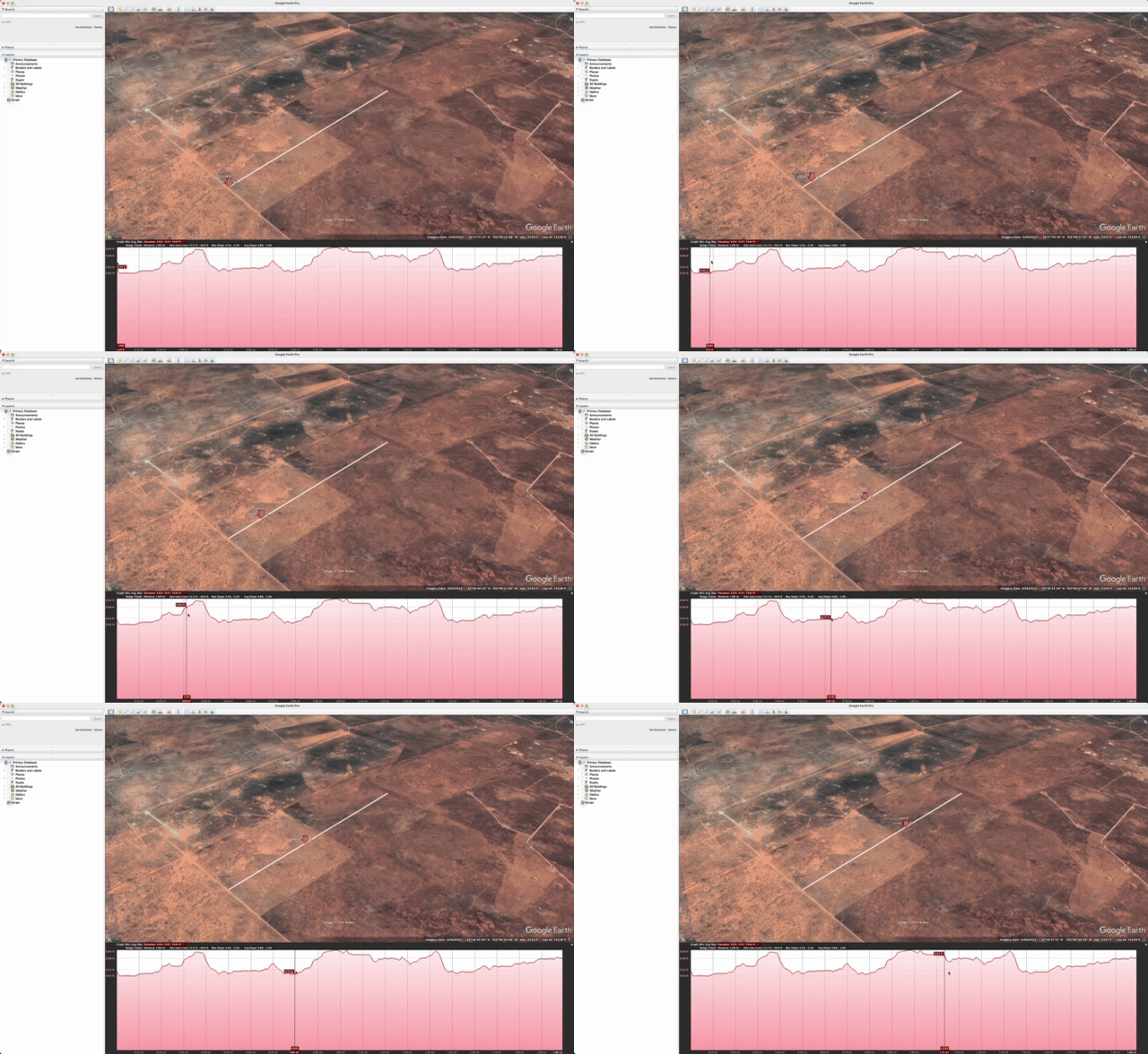
Analysis of elevation profiles and topography is also critical for site design. Construction costs for solar projects increase if the site is very hilly or slopes in an unfavorable direction. Meanwhile, placing a wind turbine on the highest peak in the area is an effective way to get more energy production out of it. Development engineers like Dan use the elevation profile tool in Google Earth Pro to understand topography concerns on the site and adapt site designs accordingly.
Collaborating with key stakeholders and in the field
Dan explained that “Everyone is familiar with Google Earth [Pro], and it is easy to use. We can share KMZ files with each other, which allows everyone involved in a project to look at the same data.” For example, a project developer can share project boundaries with Dan’s engineering team via KMZs. The engineering team can then share proposed layouts back with the project developers using KMZs as well. These files can also be opened on Google Earth on mobile by teams that are in the field, so that they can pull up project boundaries and understand where they are in relation to relevant parcels. Boots on the ground diligence is critical to project development, and using Google Earth’s mobile app ensures developers and consultants stay on the land where they have permission to go.
Importance of Measurement
But it’s not just Dan and Invenergy, Google Earth Pro is used by many clean energy partners, and we wanted to understand the real world impact it had in solar and wind project development. The true value of the tool can best be captured by:
1) The real world impact that projects are having
2) How we’re helping developers deliver this impact
Spotlight on our process
We interviewed partners that use Google Earth Pro to understand the significance it played in their process (from siting to construction). Given the partners’ feedback, we considered all the solar and onshore wind power plants built by the developers. For Solar plants we estimated the capacity factor via an EIA published dataset, then estimated the per-hour-of-the-year generation profile via PVWatts. For Wind plants, we leverage Berkeley Lab's Land-Based Wind Market Report to estimate a capacity factor and assume wind generation profile is steady throughout the year. For both solar and wind, we used NREL Cambium model to estimate the amount of emissions reduced in 2024 due to the clean energy generated.
With this process, we ended up with an estimated 15 million metric tons of GHG emissions reduction for 2024. This figure is likely conservative2, as our data only accounted for US projects from a select group of interviewed partners. In 2025, we plan to reach out to additional developers and continue to refine our impact methodology and principles.
More details on our methodology are in our recently released enabled emissions reduction principles: Google’s philosophy on how we are beginning to estimate the impact of our products through a reduction in greenhouse gas emissions by leveraging best practices from organizations such as the EGDC’s "Net Carbon Impact Assessment Methodology for ICT Solutions" and the WBCSD’s "Guidance on Avoided Emissions." We’re sharing the principles, which have been reviewed with several of our external partners, as our hope is that others can learn from and help us improve them over time. We will continue to strive to help our partners and work together!
Google Earth Pro and other decision support tools can speed up the development of these clean energy projects, ultimately speeding up the transition to clean energy at an industry-wide level.
By Brock Taute, Technical Program Manager, Data and Software Climate Solutions
Raleigh Seamster, Senior Program Manager
Grant Goodman, Senior Strategy and Operations Lead
Lusann Yang, Senior Software Engineer
Stuart Sweeney Smith, Product Analyst, Environmental Footprinting
Evan Batzer, Data Scientist
Diego Rother, Senior Software Engineer
1 To estimate the annual enabled emissions reductions in 2024, Google first interviewed partners that use Google Earth Pro to understand the significance it played in their process (from siting to construction) and considered all the solar and onshore wind power plants built by the developers. For solar plants, we estimated the capacity factor via an EIA published dataset, then estimated the per-hour-of-the-year generation profile via NREL PVWatts. For wind plants, we leveraged Berkeley Lab's Land-Based Wind Market Report to estimate a capacity factor and assume wind generation profile is steady throughout the year. For both solar and wind, we used the NREL Cambium model to estimate the amount of emissions reduced due to the clean energy generated in 2024. The estimated annual emissions reduction takes into account projects enabled by Google Earth prior to 2024 (dating back to 2020) to calculate the total impact in 2024 alone. Enabled emissions reductions estimates include inherent uncertainty due to factors that include the lack of primary data and precise information about real-world actions and their effects to date, as well as forward-looking projections. Google is relying on its own substantiation of the enabled emissions-reduction impact, in consultation with multiple third-party partners that have reviewed and support the methodology discussed herein. The data and claims have not been verified by an independent third-party. We will continue to work to refine our methodologies and inputs for these estimates.
2 Currently, we do not extrapolate from our data; instead, this estimate is based off of a number of partner interviews and isn’t extrapolated beyond their company’s projects in the US. A significance scale (see enabled emissions reduction principles) is leveraged based on how significant our contribution was in the solution, and in certain cases, we may apply a weighting to the impact estimate.

